INFOMAR Launches Blue Scale Island Series
INFOMAR (Integrated Mapping for the Sustainable Development of Ireland’s Marine Resource) has launched the Blue Scale Island Series; a new collection of high-resolution bathymetric maps showcasing the coastal waters surrounding some of Ireland’s most distinctive islands. Developed by a dedicated team of hydrographers, data processors and cartographers, the series reveals the underwater topography of these island environments in striking detail.
Ireland’s offshore islands are among the most remarkable places on the national coastline. Shaped by exposure to the Atlantic Ocean, Irish Sea and Celtic Sea, as well as by powerful tides, geological change and long human connection to the sea, they form an important part of Ireland’s natural and cultural heritage. From the dramatic Atlantic edges of the Blasket and Skellig Islands, to the seabird-rich Saltee Islands and Lambay Island in the Irish Sea, each island in the series has its own character above and below the waterline. The new collection includes Bere Island, Blasket Islands, Cape Clear, Dursey Island, Inishbofin, Inishtrahull, Lambay, Old Head of Kinsale, Saltee Islands, Scariff and Deenish, Skellig Islands and Valentia Island.
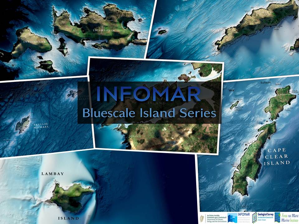
The Blue Scale Island Series brings these settings together through bathymetry, illustrating the seabed forms, submerged slopes, channels and nearshore features that define each location. In places, the maps sit alongside landscapes already well known for their heritage and biodiversity. The Skellig Islands, for example, are associated worldwide with the early monastic settlement on Sceilg Mhichíl, a UNESCO World Heritage Property, while Lambay Island is notable for its volcanic geology and internationally important seabird habitats. Cape Clear has a long maritime history and is also renowned for bird migration and observation, while the Saltee Islands are recognised as one of Ireland’s most significant seabird sanctuaries. Valentia Island, meanwhile, is linked not only to a rich maritime setting but also to the famous tetrapod trackway, one of the most important fossil trackway sites of its kind.
Other islands in the series carry equally compelling stories. Bere Island holds a strategic position in Bantry Bay and has a strong naval and military heritage. The Blasket Islands remain deeply associated with Ireland’s cultural memory and the story of the island community that lived there until the mid-twentieth century. Together, these locations reflect the diversity of Ireland’s island landscapes and the enduring relationship between coastal communities and the surrounding sea.
Like the original Blue Scale Map Series, this new collection is the culmination of many years of survey effort and careful cartographic development. Drawing on the latest high-resolution INFOMAR bathymetry data, each map has been designed to communicate the beauty and complexity of Ireland’s coastal seabed in a way that is both accessible and visually engaging. The series highlights not just the islands themselves, but the wider marine settings that shape them: reefs, shoals, basins, escarpments and channels hidden from view.
INFOMAR will make all maps in the Blue Scale Island Series available to the public as free high-resolution downloads. Released as a dedicated series, they offer an opportunity to explore Ireland’s island margins from a new vantage point and to better appreciate the detailed marine data that supports our understanding of these places.
Download the maps for yourself here and follow the series on social media (LinkedIn, Facebook and Instagram) as each new island map is released weekly! The release order is as follows:
- Friday 22nd May: Inishtrahull
- Friday 29th May: Lambay
- Friday 5th June: Cape Clear
- Friday 12th June: Bere Island
- Friday 19th June: Dursey Island
- Friday 26th June: Valentia Island
- Friday 3rd July: Blasket Islands
- Friday 10th July: Skellig Islands
- Friday 17th July: Inishbofin
- Friday 24th July: Saltee Islands
- Friday 31st July: Old Head of Kinsale
- Friday 7th August: Scariff & Deenish
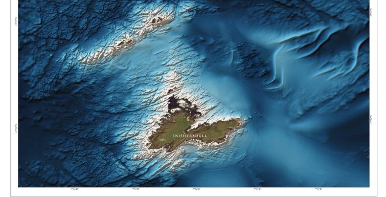
The first Island Map to be released is Inishtrahull, Donegal. Inishtrahull and the nearby Tor Rocks are situated approximately 10km north of the Inishowen Peninsula and comprise Ireland’s most northerly Islands. Inishtrahull is about 43m high and 1.5km wide. The Tor Rocks lie to the north-west and are approximately 20m high. The Islands are currently uninhabited and act as a Special Protection Area and important habitat for many different species.
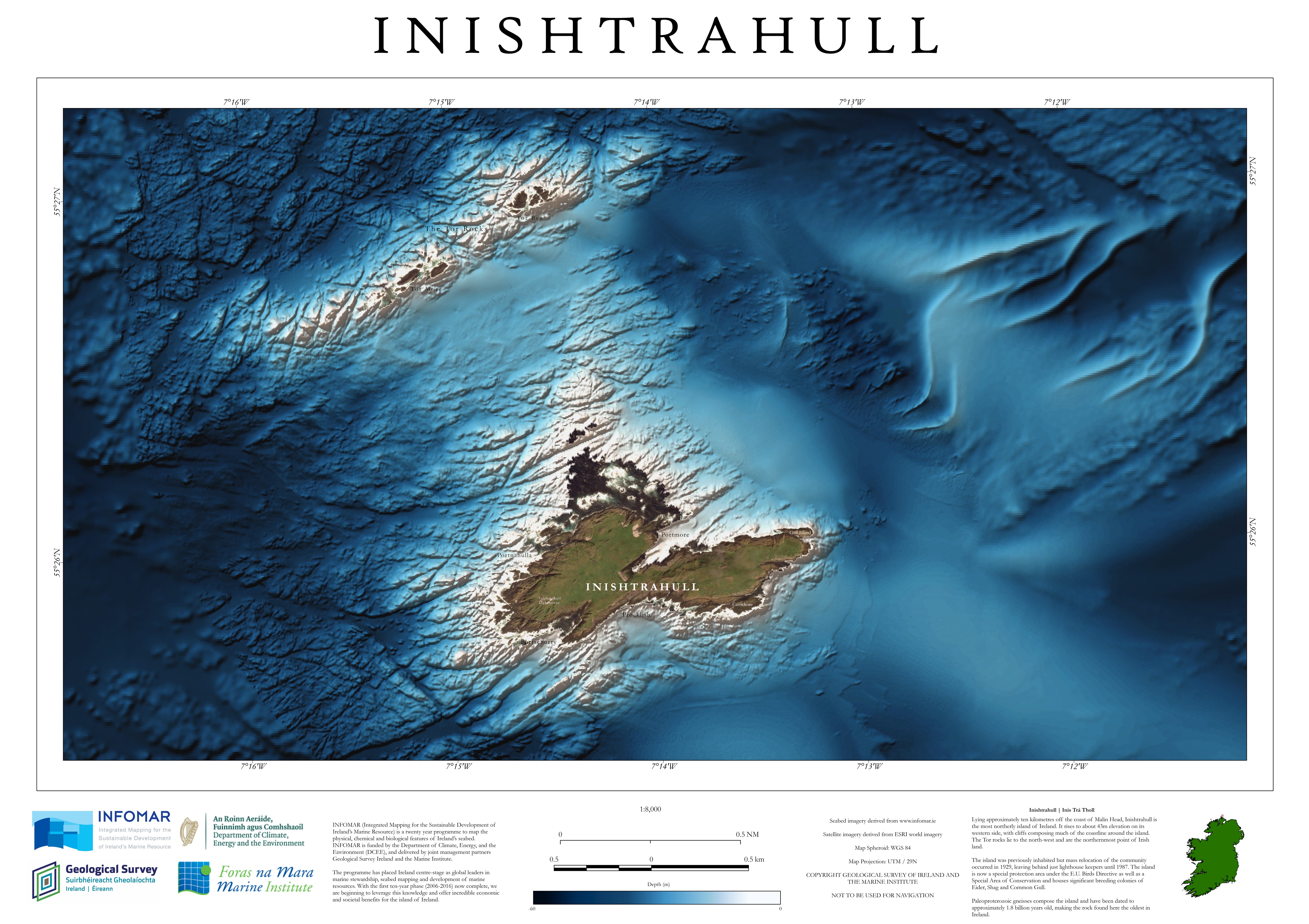
Figure 1: Inishtrahull Bluescale Map: The first of a series of twelve.
Inishtrahull lies on the Colonsay-west Islay block, a part of the earth’s crust separated from surrounding areas by faults, which are large fractures in the rock. Of the faults surrounding the block, to the north-west lies the Great Glen fault and to the south-east lies the Loch Gruinart-Leannan fault. Inishtrahull is composed of two main rock types, both originally sourced from the earth’s mantle. This material was likely placed due to tectonic activity at the margins of early continents. The first rock type making up Inishtrahull is a gneissic syenite. This is a metamorphic rock that formed when the original unit was placed under significant stress, in the form of heat and pressure. The second rock type is a gabbro, a type of igneous rock. Due to the age of the rock in the area, all the units have undergone significant changes because of heat and pressure over time.
Multiple geological structures can be observed in the bathymetric data. Offshore the north-west of the island, multiple faults are evident as clear lines cutting through the rock, sometimes even onto the island itself. A shear zone, an area that has experienced extreme stress, extends through the middle of the island from Portmore to Portachurry, creating a large depression in the bedrock. The western side of the island has less clear geological examples in the bathymetric data, but consists mostly of folding, which occurs when the earth’s crust is squashed and buckles under the pressure to form bends in the rock layers.
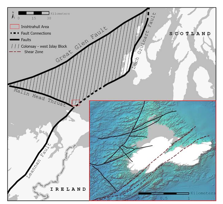
Figure 2: Schematic Map of Inishtrahull Geological Structures
Until 1991, attempts to accurately date the rock on Inishtrahull were not successful. Accurate dating came from U-Pb zircon dating. This method isolates zircon crystals from metamorphic rocks. These crystals form with the parent isotope of uranium (U) present. The isotope decays through a known amount of time, called a half-life, to form stable lead (Pb) isotopes. Based on the ratio of lead to uranium found in the crystal, the amount of time that has passed since crystallisation of the zircon can be calculated. The final age calculated for the gneiss of Inishtrahull is 1.78 billion years old, making the rock found here the oldest in Ireland. This predates the beginning of the age of the dinosaurs by about 1.5 billion years!
With the launch of the first Bluescale Island Map comes some more exciting news. INFOMAR will also be launching a Marine Geoscience Report Series to compliment the geographic locations of the Bluescale Island Maps. These reports will be released in tandem where possible and supply additional context with geoscience overviews for a general audience.
INFOMAR is a national seabed mapping programme funded by the Department of Climate, Energy and the Environment (DCEE), and jointly managed by Geological Survey Ireland and the Marine Institute, the programme has placed Ireland at the forefront of marine stewardship, seabed mapping and marine data delivery. (infomar.ie)
Founded in 1845, Geological Survey Ireland is Ireland’s national earth science knowledge centre and a division of the Department of the Environment, Climate and Communications. It provides free and open data and expertise on Ireland’s geology, groundwater, natural resources and seabed. The Marine Institute is the State agency responsible for marine research, technology development and innovation in Ireland. It provides scientific, advisory and economic development services to support the sustainable management and growth of Ireland’s marine resources.